Short Manaslu Circuit Trek (10 Days)

20th Dec, 2024
- teamramadventure
The Short Manaslu Circuit Trek is a jewel among Nepal’s trekking trails, offering unparalleled natural beauty, diverse cultural experiences, and a sense of adventure. For trekkers short on time, the 10-day Short Manaslu Circuit Trek provides a condensed yet enriching experience, covering all the highlights of this majestic route.
Table of Contents
In this guide, we’ll cover everything you need to know about the 10-day Manaslu Circuit Larkey pass Trek the detailed itinerary, distances, altitudes, best times to visit, cultural highlights, weather conditions, accommodation options, food, and more.
Overview of the Manaslu Circuit Trek
Key Facts:
-
Duration: 10 days
-
Total Distance: Approximately 177 kilometers (110 miles)
-
Highest Altitude: Larkya La Pass (5,106 meters / 16,752 feet)
-
Difficulty: Moderate to challenging
-
Best Time to Visit: March-May (Spring) and September-November (Autumn)
-
Accommodation: Teahouses
-
Permit Requirements: Manaslu Restricted Area Permit (RAP), Annapurna Conservation Area Permit (ACAP), and a TIMS card (Trekkers' Information Management System)
The Manaslu Circuit Trek is renowned for its off-the-beaten-path charm, combining remote trails with breathtaking Himalayan scenery and an immersive cultural journey.
Detailed 10-Day Itinerary
Day 1: Drive from Kathmandu to Soti Khola (700m)
-
Distance: 140 km (7-8 hours drive)
-
Highlights: Scenic drive through terraced fields, rivers, and mountain views.
-
Details: Start early from Kathmandu. The road initially follows the Prithvi Highway before branching off toward Soti Khola. Overnight in a teahouse.
Day 2: Trek from Soti Khola to Machha Khola (869m)
-
Distance: 14 km (6-7 hours)
-
Altitude Gain: +169m
-
Trail Details: A mix of rugged trails and suspension bridges through sal forests and Gurung villages. The Budi Gandaki River remains a constant companion.
Day 3: Machha Khola to Jagat (1,340m)
-
Distance: 22 km (6-7 hours)
-
Altitude Gain: +471m
-
Trail Details: Ascend through picturesque waterfalls, hot springs at Tatopani, and dense forests. Jagat is the checkpoint for your restricted area permit.
Day 4: Jagat to Deng (1,860m)
-
Distance: 20 km (6-7 hours)
-
Altitude Gain: +520m
-
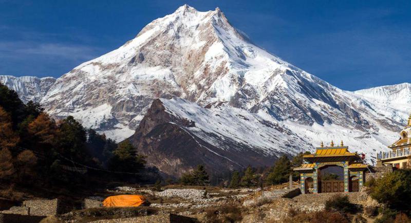
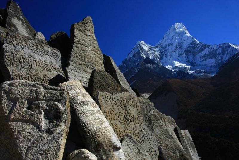
Highlights: Buddhist Mani walls, lush forests, and glimpses of Mount Manaslu.
Day 5: Deng to Namrung (2,630m)
-
Distance: 19 km (6-7 hours)
-
Altitude Gain: +770m
-
Cultural Insights: Encounter Tibetan-influenced villages and monasteries. Namrung offers stunning views of Ganesh Himal.
Day 6: Namrung to Samagaun (3,520m)
-
Distance: 17 km (6-7 hours)
-
Altitude Gain: +890m
-
Details: A gradual ascent with majestic views of Manaslu. Explore the rich Tibetan culture in Samagaun.
Day 7: Acclimatization Day in Samagaun
-
Activities: Visit the Pungyen Gompa or hike to Manaslu Base Camp (4,400m).
-
Purpose: Acclimatize for the high-altitude crossing ahead.
Day 8: Samagaun to Dharmashala (4,460m)
-
Distance: 14 km (6-7 hours)
-
Altitude Gain: +940m
-
Highlights: Alpine landscapes, yak pastures, and close-up views of snow-capped peaks.
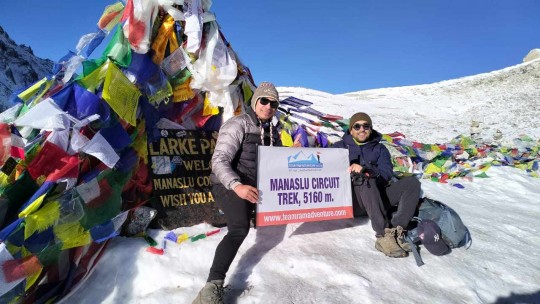
Day 9: Cross Larkya La Pass (5,106m) and Descend to Bimtang (3,590m)
-
Distance: 24 km (10-12 hours)
-
Altitude Gain: +646m (to the pass), then descend -1,516m
-
Details: The most challenging day of the trek with dramatic Himalayan vistas from the pass.
Day 10: Trek from Bimtang to Dharapani (1,963m) and Drive to Kathmandu
-
Distance: 27 km (7-8 hours trek + 8-9 hours drive)
-
Altitude Loss: -1,627m
-
Trail Details: Descend through rhododendron forests and terraced fields. Drive back to Kathmandu to conclude your journey.
Total Distance and Trekking Hours
-
Trekking Distance: Approximately 177 kilometers
-
Daily Trekking Hours: 6-12 hours (varies by day and altitude)
Altitudes and Acclimatization
-
The trek ascends gradually to ensure proper acclimatization.
-
Acclimatization days, such as in Samagaun, help prevent altitude sickness.
Best Time to Visit the Manaslu Circuit
-
Spring (March-May):
-
Weather: Clear skies and blooming rhododendrons.
-
Advantages: Ideal temperatures and vibrant landscapes.
-
-
Autumn (September-November):
-
Weather: Stable weather and excellent visibility.
-
Advantages: Best time for trekking with moderate crowds.
-
-
Winter (December-February):
-
Challenges: Cold temperatures and snow-covered passes.
-
Recommendation: Suitable for experienced trekkers.
-
-
Monsoon (June-August):
-
Challenges: Slippery trails and heavy rainfall.
-
Recommendation: Not ideal due to landslides and leeches.
-
Cultural Highlights
-
Ethnic Diversity: Home to Gurung, Tamang, and Tibetan communities.
-
Monasteries: Visit Pungyen Gompa and other Buddhist sites.
-
Traditions: Observe unique Tibetan-inspired rituals, festivals, and lifestyles.
Weather Conditions
-
Temperature Ranges:
-
Low Altitudes: 10°C to 25°C (daytime)
-
High Altitudes: -10°C to 10°C (daytime)
-
-
Precipitation: Varies by season; autumn and spring are the driest.
-
Snowfall: Common above 4,000m in winter.
Accommodation
-
Teahouses: Basic but comfortable lodges offering food and lodging.
-
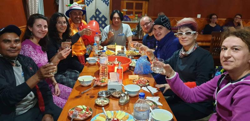
Facilities: Shared rooms, communal dining areas, and limited hot showers.
Food on the Trail
-
Staples: Dal Bhat (lentil soup with rice), noodles, pasta, and Tibetan bread.
-
Snacks: Energy bars, boiled eggs, and seasonal fruits.
-
Drinks: Tea, coffee, and safe drinking water (treated/boiled).
Tips for Trekking the Manaslu Circuit
-
Permits: Ensure you have all required permits.
-
Guide and Porter: Hiring a guide is mandatory for the restricted area.
-
Packing: Bring warm clothing, trekking poles, and altitude medication.
-
Physical Fitness: Train for endurance and altitude readiness.
-
Cash: Carry sufficient cash as ATMs are unavailable.


 Plan Your Trip Now





















.jpg)


.jpg)


.jpg)

